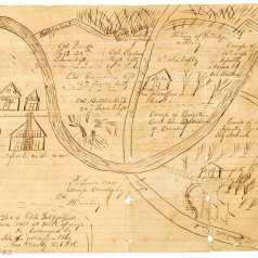
This military map was hand-drawn on linen by Albert Martin, a Confederate cartographer, around 1861, and stretches along the Mississippi River from Ashport in the north to Memphis in the south. Though detailed in its presentation of waterways, swamps, bluffs, plantations, certain landowners, and the numbered islands in the Mississippi River, its primary purpose was the location of Fort Harris and Fort Claiborn and the indications given of artillery batteries and troop deployments in the area.