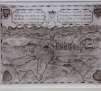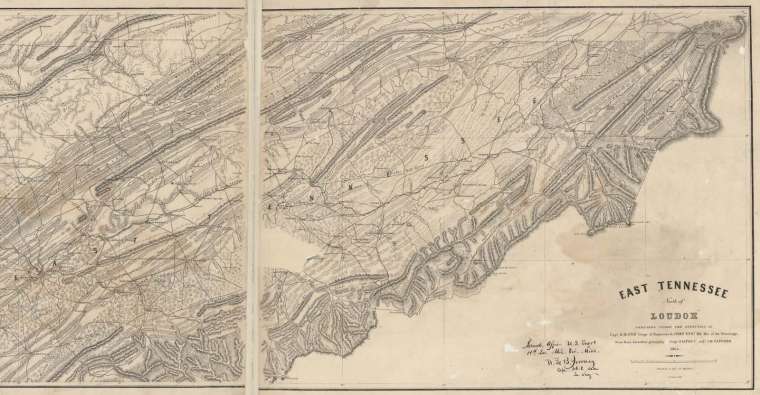
This detailed map features forts, towns, post offices, topography, roads, railroads, valleys, rivers, creeks, islands, fords, ferries, elevations, iron furnaces, poor houses, mills, and forges in the East Tennessee area. It indicates that data was furnished by Capt. O. E. Poe and Prof. J. M. Safford, and it carries the signature of W. L. B. Jenney, Capt., U.S.A.